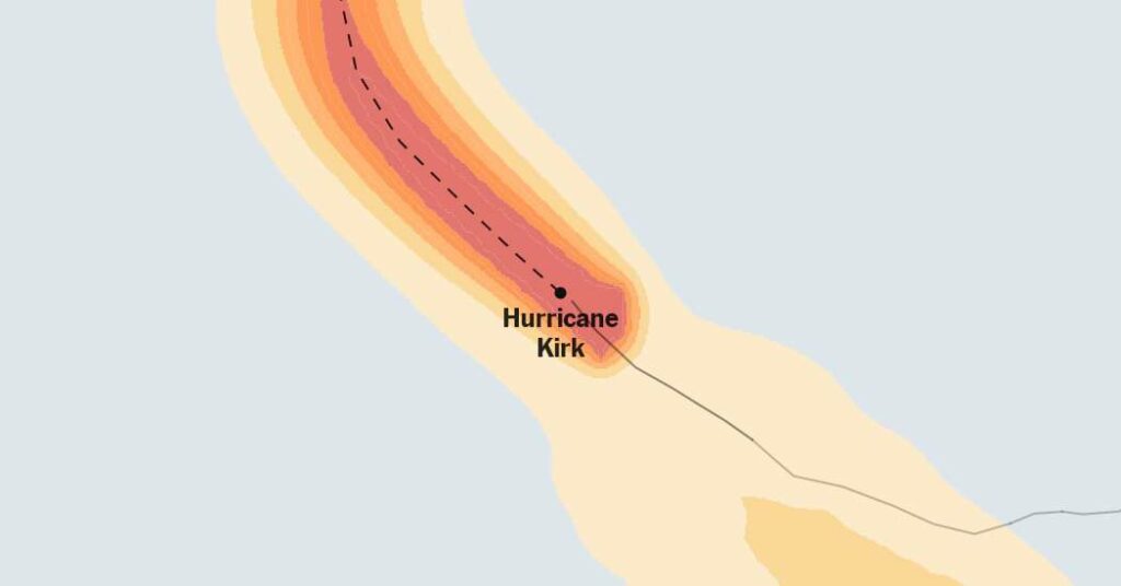
Kirk: A Category 3 Hurricane in the North Atlantic
Kirk, a Category 3 hurricane in the North Atlantic Ocean, has been reported to have sustained wind speeds of 125 miles per hour. This latest advisory from the National Hurricane Center marks its presence and potential impact on the region.
Where will it rain?
Flash flooding can occur well inland and away from the storm’s center. Even weaker storms have the potential to produce excessive rainfall that has the capacity to flood low-lying areas, making it imperative for residents to prepare for the possible aftermath.
What does the storm look like from above?
Satellite imagery is a valuable tool in determining the strength, size, and cohesion of a storm. The development of an eye in the center of a storm indicates its increasing strength, and when the eye appears symmetrical, it implies that the storm is encountering nothing that will weaken it.
Current Hurricane Season
Kirk is the 11th named storm to form in the Atlantic in 2024. The National Oceanic and Atmospheric Administration’s prediction of 17 to 25 named storms this year, an above-normal amount, highlights the potential severity of the current season/” title=”NYC at risk for floods as forecasts call for a busy hurricane season”>hurricane season. The warm ocean temperatures and diminishing El Niño pattern are creating a more suitable atmosphere for storms to form and intensify.
The Impact of Oceanic Conditions
The warm ocean temperatures that fueled last year’s hurricane season have returned even warmer at the start of this season, raising forecasters’ confidence that there would be more storms this year. These heightened sea surface temperatures could also strengthen storms more rapidly than usual.
Moreover, the diminishing El Niño pattern is creating a more favorable environment for storm formation and intensification. Hurricanes need a calm environment to form, and with the absence of a strong El Niño, the conditions are conducive for the formation of powerful cyclones.
New Data and Sources
The tracking map, wind arrivals table, radar map, storm surge map, satellite map, and precipitation map provide valuable information based on data from the National Hurricane Center, the National Oceanic and Atmospheric Administration, the U.S. Census Bureau, and various other sources. This data is crucial in predicting the impact and distribution of the hurricane’s force and hence, in strategizing effective response and preparedness measures.
the current hurricane season is forecasted to be particularly active, and it is essential for residents in the affected regions to stay informed and prepared for the potential impact of storms.

